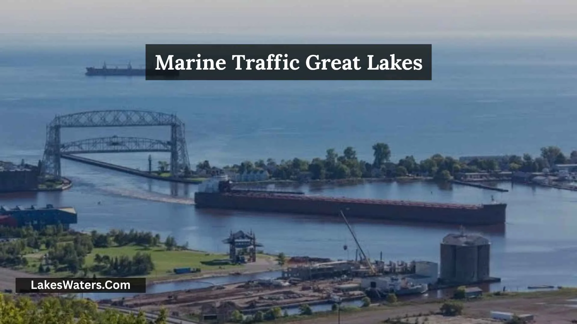
If you are searching for Marine Traffic Great Lakes, you are likely trying to find ships on a live map, track a Great Lakes freighter, check a vessel’s current position, see where a ship is headed, or find its estimated arrival time.
Great Lakes ship traffic can be monitored through AIS-based services such as MarineTraffic, while the official Great Lakes–St. Lawrence Seaway system provides its own vessel-tracking and transit information. The Seaway’s Voyage Information System (VIS) allows ships to be tracked in real time across the Great Lakes and St. Lawrence River network, while NOAA’s AccessAIS is designed more for accessing and analyzing U.S. vessel-traffic data.
This guide explains how Great Lakes marine traffic tracking works, how to find a specific ship, what AIS information means, why a vessel’s position can become outdated, how to compare tracking services, and which source to use for different tracking needs.
Quick Answer: How Do You Track Marine Traffic on the Great Lakes?
The easiest way to watch Great Lakes ships is to use an AIS-based vessel-tracking map such as MarineTraffic.
For more specialized information, several options are available:
| What You Want to Do | Useful Resource |
| Watch ships on an interactive map | MarineTraffic |
| Check a vessel’s latest AIS position | MarineTraffic |
| Track vessels across the Great Lakes and St. Lawrence network | Seaway Voyage Information System |
| Check Seaway vessel transit information and ETAs | Great Lakes–St. Lawrence Seaway Vessel Transit Information |
| Analyze or download U.S. AIS traffic data | NOAA AccessAIS |
| Verify AIS static vessel information | U.S. Coast Guard VIVS |
MarineTraffic says its live map uses AIS information collected through its receiving network. The Seaway’s VIS is specifically designed for real-time vessel tracking across the Great Lakes and St. Lawrence River network. NOAA’s AccessAIS serves a different purpose by providing downloadable U.S. vessel-traffic data for selected locations and time periods.
The important point is that these services are not interchangeable. A live ship map, an official Seaway tracking system, a historical AIS dataset, and a vessel-information verification service each answer different questions.
What Is Marine Traffic on the Great Lakes?
Marine traffic means the movement of vessels across the Great Lakes and their connected waterways.
This includes commercial freighters, bulk carriers, tankers, tugboats, barges, passenger vessels, research vessels, and other AIS-equipped ships.
The Great Lakes are connected to the St. Lawrence River and Atlantic Ocean through the Great Lakes St. Lawrence Seaway System. This network allows commercial vessels to move cargo between inland ports and international markets.
For people watching ships, this creates a large and constantly changing network of vessel movements. A tracking map can show ships crossing open water, approaching ports, moving through channels, or traveling toward locks and other parts of the Seaway system.
Why Great Lakes Ship Traffic Matters
Great Lakes shipping supports the movement of bulk and other cargo between ports throughout the region.
The marine network is also important for:
- Commercial transportation
- Port operations
- Industrial supply chains
- Agricultural exports
- Mining-related cargo
- Maritime research
- Vessel traffic management
- Ship watching and photography
AIS makes much of this movement easier to observe because equipped vessels broadcast information that can be received by other ships and shore-based systems. The U.S. Coast Guard describes AIS as a maritime safety communications system that provides information such as vessel identity, type, position, course, speed, and navigational status.
What Is AIS and How Does It Track Great Lakes Ships?
AIS stands for Automatic Identification System.
It is a maritime communication system that automatically exchanges information between appropriately equipped vessels, shore stations, and other authorized users.
AIS can provide information such as:
- Vessel name
- Vessel type
- Position
- Course
- Speed
- Navigational status
- MMSI
- Call sign
- Dimensions
- Draft
- Other voyage-related information
The U.S. Coast Guard identifies AIS as a standardized maritime safety communications system adopted through international maritime standards.
How AIS Creates a Ship-Tracking Map
The basic process is straightforward:
Ship’s AIS equipment
↓
Broadcasts vessel information
↓
AIS receiving station or other receiver detects the signal
↓
Tracking service processes the information
↓
Vessel appears on a map
MarineTraffic explains that its network receives AIS transmissions through coastal receiving stations and processes the information in its database for display on its Live Map.
The Great Lakes–St. Lawrence Seaway also uses AIS as part of its traffic-management system. The Seaway says AIS provides vessel position, speed, and course information and integrates with its Traffic Management System.
Is AIS the Same as Radar?
No.
AIS and radar provide different types of information.
Radar detects objects using radio waves and is an important navigation and situational-awareness system. AIS, by contrast, involves vessels transmitting identification and navigation information.
A tracking website may therefore show an AIS-derived vessel position without representing everything that a professional mariner sees on onboard navigation equipment.
This distinction is important when interpreting public ship-tracking websites.
How to Use MarineTraffic to Track Great Lakes Ships
MarineTraffic is useful when your goal is to see vessels on an interactive map and inspect individual ship information.
Find the Great Lakes on the Live Map
Open the MarineTraffic map and move to the Great Lakes region.
You can zoom toward:
- Lake Superior
- Lake Michigan
- Lake Huron
- Lake Erie
- Lake Ontario
- St. Lawrence River
- Major ports and waterways
The vessels displayed depend on available AIS data and receiving coverage. MarineTraffic explains that its coverage can vary when ships move outside the range of coastal receiving stations.
Select a Vessel
When you see a ship you want to investigate, select its icon.
Depending on the available information, the vessel page can provide details such as:
- Current or latest position
- Latitude and longitude
- AIS source
- Speed
- Course
- Destination
- Voyage information
- Vessel characteristics
- Port calls
MarineTraffic’s current documentation identifies a Latest Position section containing coordinates and the AIS source for the reported position.
Check the Last AIS Update
This is one of the most important steps when using any public ship tracker.
Do not assume that the ship icon represents a position received seconds ago.
MarineTraffic provides a Data received on timestamp showing when the network last received the vessel’s AIS position. It also displays a last-update indicator in the vessel information.
For example:
Ship position: Lake Erie
Last AIS update: 4 minutes ago
That tells you something very different from:
Ship position: Lake Erie
Last AIS update: 2 hours ago
The map location alone does not provide that context.
How Accurate Is MarineTraffic on the Great Lakes?
MarineTraffic can provide useful near-real-time vessel information, but the freshness of a position depends on when AIS data was received and what receiving source was available.
MarineTraffic states that positions are updated when new AIS information is received. Its documentation also notes that a vessel can stop receiving position updates when it moves outside the range of coastal receiving stations.
Why Position Updates Can Differ
AIS transmission frequency is not always the same.
It can vary according to factors such as:
- AIS equipment class
- Vessel speed
- Navigation status
- Course changes
- Receiving coverage
- Data source
MarineTraffic’s documentation gives different transmission intervals depending on vessel status and AIS class.
That means two screenshots of the same vessel can show slightly different positions without either map necessarily being wrong.
What the Timestamp Tells You
The timestamp answers an important question:
“When was this position actually received?”
MarineTraffic recommends checking the last update time alongside the coordinates when judging how current a vessel’s location is.
This is particularly useful if you are trying to see whether a freighter is approaching a port or viewing location.
Why Does a Great Lakes Ship Sometimes Disappear From the Map?
A missing vessel icon does not automatically mean something happened to the ship.
There are several possible explanations.
The Vessel May Be Outside Receiving Coverage
MarineTraffic explains that coastal AIS receiving stations have a limited range. When a vessel moves outside available receiving coverage, its position may stop refreshing.
The Last Position May Be Old
A ship can remain associated with its last known position even though it has continued moving.
This is why the timestamp matters.
The AIS Source May Be Different
MarineTraffic identifies terrestrial, satellite, and roaming AIS sources.
Terrestrial AIS is received by land-based stations. Satellite AIS can provide positions beyond the range of terrestrial stations, while roaming positions come through shared receiver networks.
Different sources can have different update characteristics.
AIS Can Be Temporarily Unavailable
Equipment, transmission, reception, coverage, or operational circumstances can affect the information available to a public tracking service.
For that reason, a missing or delayed position should not be interpreted on its own as evidence of an emergency.
What Does the AIS Source Mean?
When looking at a vessel’s position, the source can provide useful context.
Terrestrial AIS
A terrestrial position comes from a land-based AIS receiver.
This is especially relevant around ports, coastlines, and areas covered by shore stations.
Satellite AIS
Satellite AIS receives AIS transmissions through satellites.
It can help provide vessel positions beyond terrestrial receiving coverage, although update intervals can differ.
MarineTraffic notes that satellite and terrestrial AIS have different coverage characteristics.
Roaming AIS
Roaming refers to positions received through shared AIS receiver networks.
The exact source matters less than the practical question:
How recent is the reported position?
Always check the timestamp.
How to Track a Specific Great Lakes Freighter
If you know a vessel’s name, searching directly is usually easier than scanning an entire lake.
Search by Vessel Name
Enter the vessel name into the tracking service.
Once you find the correct ship, check its:
- Name
- Position
- Last AIS update
- Course
- Speed
- Destination
- Vessel identity information
This helps avoid confusing vessels with similar names.
Use MMSI or Other Identifiers When Available
A vessel name can change or be displayed differently across services.
For more precise identification, useful identifiers can include:
- MMSI
- IMO number
- Call sign
- Official vessel name
The U.S. Coast Guard’s VIVS can retrieve AIS static information such as MMSI, call sign, vessel name, dimensions, draft, type, and positioning source within its coverage area.
MarineTraffic vs. Official Great Lakes Tracking Tools
A major mistake is assuming that one website is the best source for every type of question.
Different tools have different purposes.
| Tool | Main Purpose | Best Use |
| MarineTraffic | AIS vessel tracking | Watching ships and checking vessel details |
| Seaway VIS | Great Lakes and St. Lawrence vessel tracking | Operational vessel tracking and traffic information |
| Seaway Vessel Transit Information | Seaway transit information | Vessel name, location, ATA and ETA information |
| NOAA AccessAIS | AIS data access and analysis | Research and traffic analysis |
| USCG VIVS | AIS static-data verification | Checking vessel identity information |
This distinction makes it easier to choose the right source instead of treating every tracking map as identical.
How the Great Lakes Seaway VIS Works
The Voyage Information System (VIS) is an official Great Lakes and St. Lawrence River marine collaboration platform.
Its website states that VIS allows ships to be tracked in real time throughout the Great Lakes and St. Lawrence River network. It also provides ETA predictions and vessel traffic conditions.
This makes VIS particularly relevant when your interest is commercial vessel movement through the wider Great Lakes–St. Lawrence network.
What Can You Use VIS For?
VIS can be useful for:
- Vessel tracking
- ETA information
- Vessel traffic conditions
- Monitoring commercial movements
- Following ships through the Great Lakes and St. Lawrence system
It is a different type of resource from a general consumer ship map because it is built around the marine industry’s movement of cargo into, out of, and within the Great Lakes system.
How to Check Great Lakes Vessel Transit Information
The official Seaway Vessel Transit Information page provides a vessel-name search and displays transit information such as:
- Vessel name
- Fleet
- Direction
- Last location
- Actual time of arrival
- Next location
- Estimated time of arrival
The system currently exposes these fields directly in its vessel-transit table.
Why Official Transit Information Is Useful
Suppose you are following a freighter that is expected to pass through the Seaway.
Instead of relying only on a consumer map, you can compare:
Current AIS position
with
Official Seaway transit information
This can give you more context about where the vessel is within the Seaway system and where it is expected to go next.
What Is the U.S. Coast Guard VIVS?
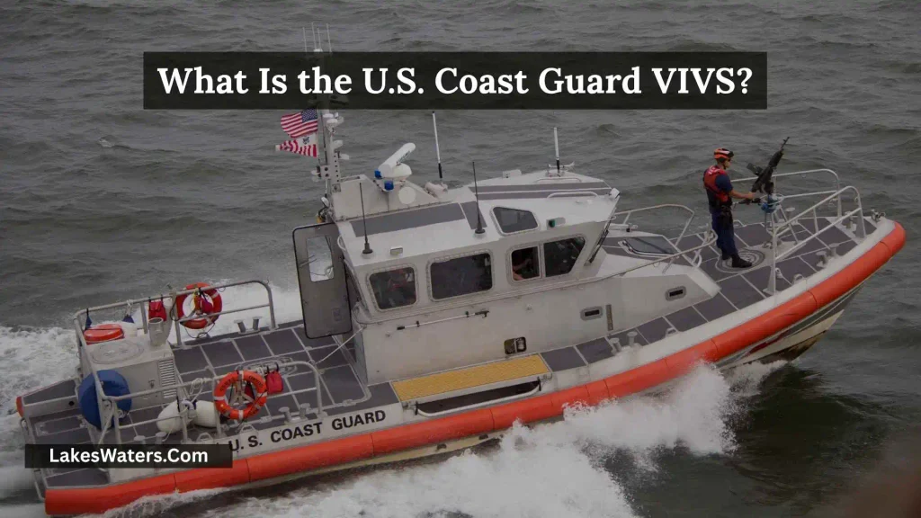
The Vessel Information Verification System, or VIVS, is different from a live ship-tracking map.
The U.S. Coast Guard describes VIVS as a tool for retrieving and verifying a vessel’s static AIS information within its Nationwide AIS coverage area.
It can include:
- MMSI
- Call sign
- Vessel name
- Vessel dimensions
- Draft
- Vessel type
- Positioning source
Is VIVS a Live Great Lakes Ship Tracker?
No.
This distinction is important.
The Coast Guard explicitly says VIVS results are not worldwide or real-time and may lag by up to two business days. Its data is intended for AIS static-data verification rather than following a ship’s movement minute by minute.
Use MarineTraffic or another live AIS service when you want to watch vessel movement.
Use VIVS when you want to verify static AIS vessel information.
How NOAA AccessAIS Fits Into Great Lakes Ship Tracking
NOAA’s AccessAIS is another useful resource, but it serves a different audience.
AccessAIS allows users to interactively download U.S. vessel-traffic data for selected geographic areas and time periods. It also provides visualizations of vessel traffic patterns and vessel counts.
Who Should Use AccessAIS?
It can be useful for:
- Researchers
- Students
- Marine planners
- Data analysts
- Environmental researchers
- Transportation researchers
- People studying historical vessel movements
It is not simply a replacement for a live ship map.
Think of it this way:
MarineTraffic → “Where is the ship?”
Seaway VIS → “How are vessels moving through the Great Lakes–St. Lawrence network?”
NOAA AccessAIS → “What does the vessel-traffic data show over a selected area and period?”
USCG VIVS → “What static AIS information is associated with this vessel?”
Great Lakes Marine Traffic and the Seaway AIS System
AIS is not only useful to people watching ships online.
It is also an important part of the actual Seaway traffic-management system.
The Great Lakes–St. Lawrence Seaway says its AIS system provides vessel location, speed, and course information and integrates that information with traffic management. It also supports information such as water levels, flows, ice conditions, lock availability, and safety messages within the Seaway system.
When Did AIS Become Important in the Seaway?
The Seaway introduced AIS into its traffic-management system in the early 2000s.
The Seaway’s current historical information notes that AIS was implemented as part of its effort to improve navigation safety and efficiency.
The Seaway later made AIS carriage mandatory for specified commercial vessels transiting its waters.
This history matters because today’s public ship-tracking experience is connected to a broader maritime system that was developed for navigation, safety, and traffic management—not simply for online ship watching.
What Types of Ships Can You See on Great Lakes Marine Traffic Maps?
Great Lakes tracking maps can show many kinds of vessels.
Lakers
Lakers are vessels designed for Great Lakes and inland-waterway operations.
Many are bulk carriers that transport cargo such as ore, grain, stone, or other commodities.
Salties
Salties are ocean-going vessels that enter the Great Lakes through the St. Lawrence Seaway.
They may be designed for ocean service but can travel inland through the Seaway where vessel dimensions and operating conditions permit.
Tankers
Tankers transport liquid cargo and can appear on AIS tracking maps.
Tugboats and Barges
Tugboats may move barges and other floating equipment around ports and waterways.
Passenger Vessels
Passenger ships and ferries can also appear when they transmit AIS and the relevant tracking service receives the data.
Research and Government Vessels
Some research, government, and specialized vessels may also appear depending on their AIS equipment and transmission status.
Which Great Lakes Have Marine Traffic?
All five Great Lakes can have vessel traffic, although the type and amount of traffic varies by location, season, port activity, cargo movements, weather, and vessel routes.
Lake Superior
Lake Superior is an important part of the upper Great Lakes shipping network.
Commercial vessels travel between ports and connecting waterways, including routes toward the St. Marys River.
Lake Michigan
Lake Michigan has commercial port activity around several major population and industrial centers.
The lake is also connected to waterways around Chicago and the broader inland transportation network.
Lake Huron
Lake Huron sits between Lake Michigan and Lake Erie and is an important route within the Great Lakes system.
The St. Marys River connects Lake Superior with Lake Huron.
Lake Erie
Lake Erie is a major part of the eastern Great Lakes shipping network.
It connects with Lake Ontario through the Welland Canal and has numerous commercial ports.
Lake Ontario
Lake Ontario forms the eastern end of the Great Lakes before the route continues into the St. Lawrence River.
Ships traveling through the Seaway can continue toward the Atlantic Ocean.
How to Track a Ship Near a Great Lakes Port
If your goal is to see whether a particular vessel is approaching a port, follow a few simple steps.
Step 1: Identify the Port
Start with the port or waterfront area you are interested in.
Step 2: Search the Vessel
If you know the ship’s name, search for it directly.
Step 3: Check the Latest Position
Look at the vessel’s coordinates and last update time.
Step 4: Check Course and Speed
These help you understand whether the ship is actually heading toward your area.
Step 5: Check the Destination
The destination can provide useful context about the vessel’s voyage.
Step 6: Compare With Official Seaway Information
If the vessel is traveling through the Seaway, compare public AIS information with official Seaway transit information when available.
Step 7: Plan Around the ETA, Not Just Distance
A vessel’s straight-line distance from you does not necessarily tell you when it will arrive.
Channels, port approaches, locks, traffic, speed changes, and other operational factors can affect the actual voyage.
Can MarineTraffic Tell You When a Ship Will Reach You?
MarineTraffic can provide an estimated arrival time to a user’s location in supported circumstances.
Its current documentation says the ETA-to-location calculation uses the vessel’s latest reported speed, current course, and the user’s GPS position. It also warns that the estimate assumes the vessel maintains its current speed and course and does not account for every possible route change, stop, speed change, or port call.
That makes the ETA useful as an estimate, not a guarantee.
Why ETA Can Change
An estimated arrival time can change because:
- Vessel speed changes
- Course changes
- The ship makes a port call
- Weather affects the voyage
- Traffic conditions change
- A vessel waits for operational reasons
- The tracking position becomes outdated
For ship watching, ETA is best used together with the latest AIS update and vessel course.
How to Use Marine Traffic for Ship Watching
AIS tracking can make Great Lakes ship watching much easier.
Instead of waiting at the waterfront without knowing which vessels are nearby, you can use a tracking map to identify ships that may be approaching.
A Practical Ship-Watching Workflow
Choose a viewing location
↓
Open a Great Lakes vessel map
↓
Find nearby ships
↓
Check destination and course
↓
Check last AIS update
↓
Estimate arrival time
↓
Follow local waterfront safety rules
This approach is particularly useful for photographers and ship enthusiasts.
Do not enter restricted port property, industrial areas, private land, or navigation channels simply to get a better view.
Common Mistakes When Using Great Lakes Ship Trackers
Mistake 1: Treating Every Icon as Live
A vessel icon can represent the most recently received AIS position rather than its exact position at the moment you look at the map.
Better approach: Always check the last-update timestamp.
Mistake 2: Assuming a Missing Vessel Is in Trouble
A missing AIS position can have several explanations.
Better approach: Check other sources and the vessel’s last known information before drawing conclusions.
Mistake 3: Confusing VIVS With Live Tracking
USCG VIVS is designed for static AIS information verification and is not a worldwide real-time tracker.
Better approach: Use a live AIS service for movement and VIVS for static-data verification.
Mistake 4: Treating ETA as a Guarantee
An ETA is an estimate.
Better approach: Compare ETA with the latest position, course, speed, and official Seaway information when appropriate.
Mistake 5: Assuming Two Tracking Services Must Match Exactly
Different services may receive data from different networks or at different times.
Better approach: Compare the timestamp and data source before deciding that two positions conflict.
A Simple Marine Traffic Great Lakes Decision Guide
Use this quick decision tree to choose the right tool.
Do you want to watch ships move on a map?
↓
MarineTraffic
Do you want real-time tracking across the Great Lakes and St. Lawrence River network?
↓
Seaway Voyage Information System
Do you want vessel transit and ETA information in the Seaway?
↓
Seaway Vessel Transit Information
Do you want downloadable U.S. vessel-traffic data for research?
↓
NOAA AccessAIS
Do you want to verify AIS static information such as MMSI, name, dimensions, or type?
↓
U.S. Coast Guard VIVS
This division of tasks prevents a common problem: using a specialized database as though it were a live tracking map.
Marine Traffic Great Lakes: What You Should Check First
When opening a ship-tracking map, use this checklist.
Great Lakes Vessel Tracking Checklist
- Correct vessel name
- Current or latest position
- Last AIS update
- AIS source
- Vessel speed
- Vessel course
- Destination
- ETA, if available
- Vessel identity information
- Official Seaway information when relevant
The last AIS update is especially important because it tells you how fresh the displayed position is. MarineTraffic specifically provides this timestamp so users can assess the currency of the position data.
Frequently Asked Questions About Marine Traffic Great Lakes
Can I Track Ships on the Great Lakes?
Yes. AIS-based services such as MarineTraffic can display Great Lakes vessel positions when relevant AIS data is available. The official Seaway VIS also provides real-time tracking throughout the Great Lakes and St. Lawrence River network.
What Is the Best Way to Track a Great Lakes Freighter?
For an interactive map and vessel details, MarineTraffic is a practical option. If the ship is moving through the Great Lakes–St. Lawrence Seaway network, the official Seaway tracking systems can provide additional transit information.
Can I Track a Ship by Name?
Yes. Vessel-name searching is available through MarineTraffic and the Seaway’s Vessel Transit Information system. The Seaway’s system specifically provides a vessel-name search and transit fields such as last location and ETA.
Why Is My Ship Not Showing on MarineTraffic?
The vessel may be outside the available receiving coverage, its AIS information may not currently be available, or the tracking service may not have received a recent position. MarineTraffic explains that vessel positions may stop refreshing when a ship moves outside the range of coastal receiving stations.
How Often Does MarineTraffic Update Ship Positions?
AIS transmission frequency varies according to factors such as the vessel’s AIS class, speed, navigation status, and course changes. MarineTraffic documents different transmission intervals for different operating conditions.
What Does “Last AIS Update” Mean?
It shows when the tracking network last received an AIS position from the vessel. MarineTraffic recommends checking this timestamp when assessing how current the displayed location is.
Is MarineTraffic the Same as the Official Great Lakes Seaway Tracker?
No. MarineTraffic is a commercial AIS-based vessel information service. The Great Lakes–St. Lawrence Seaway operates its own tracking and transit-information systems, including VIS and Vessel Transit Information.
Is the Great Lakes Seaway VIS Real Time?
The official VIS website describes the system as allowing ships to be tracked in real time throughout the Great Lakes and St. Lawrence River network.
What Is the Difference Between AIS and MarineTraffic?
AIS is the underlying maritime communication and identification technology. MarineTraffic is a service that collects and processes AIS information and presents vessel information to users.
In simple terms:
AIS = the vessel-information system
MarineTraffic = a service that uses AIS data
Is USCG VIVS a Live Ship Tracker?
No. The U.S. Coast Guard says VIVS provides AIS static data within its NAIS coverage area and is not worldwide or real time. The service may lag by up to two business days.
What Is NOAA AccessAIS Used For?
NOAA AccessAIS lets users download U.S. vessel-traffic data for selected locations and time periods and provides visualizations of traffic patterns and vessel counts. It is more useful for data analysis and research than casual live ship watching.
Can I Track Ships on Lake Superior?
Yes. AIS-equipped vessels on Lake Superior may appear on vessel-tracking services when their AIS transmissions are received and available to the service.
Can I Track Ships on Lake Michigan?
Yes. AIS-equipped vessels on Lake Michigan can appear on public ship-tracking services when data is available.
Can I Track Ships on Lake Erie?
Yes. Lake Erie is part of the Great Lakes shipping network, and AIS-equipped vessels can be monitored through relevant tracking services.
Can I Track Ships on Lake Huron and Lake Ontario?
Yes. AIS-based tracking services can show vessels on both lakes when relevant position data is available.
Can MarineTraffic Show a Ship’s Exact Coordinates?
MarineTraffic provides latitude and longitude for a vessel’s reported position. However, the coordinates represent the latest AIS position received, so users should check the last-update timestamp to understand how current that position is.
Can I Use Public Ship Tracking for Navigation?
Public ship-tracking websites should not replace professional navigation equipment, official maritime information, or required navigational procedures. Their data can be delayed or affected by coverage and transmission conditions.
Conclusion
Marine Traffic Great Lakes is a useful starting point for anyone who wants to follow freighters, identify vessels, check ship positions, or understand traffic across the Great Lakes.
The key is knowing what each source actually does. MarineTraffic is useful for interactive AIS-based vessel tracking. The Seaway’s VIS provides real-time tracking across the Great Lakes and St. Lawrence River network, while its Vessel Transit Information system provides useful transit and ETA details. NOAA AccessAIS is better suited to vessel-traffic data analysis, and USCG VIVS is intended for checking static AIS vessel information rather than live movement.
When tracking a Great Lakes ship, the most important habit is simple: do not look at the ship icon alone. Check the last AIS update, source, course, speed, and destination. If the vessel is traveling through the Seaway, compare the information with the official Seaway systems when appropriate.
That gives you a more accurate understanding of where a ship was reported, where it appears to be going, and how current the tracking information really is.

I am Ethan Reynolds, a nature researcher and writer focused on freshwater environments, aquatic ecosystems, and sustainable water solutions.
I enjoy sharing knowledge about lakes, rivers, wetlands, and the challenges facing global water resources.
My goal is to help readers understand the value of water and encourage responsible actions to protect it.
Books by Ethan Reynolds:
- Lakes and Landscapes: Stories from Nature
- Protecting Water for Future Generations