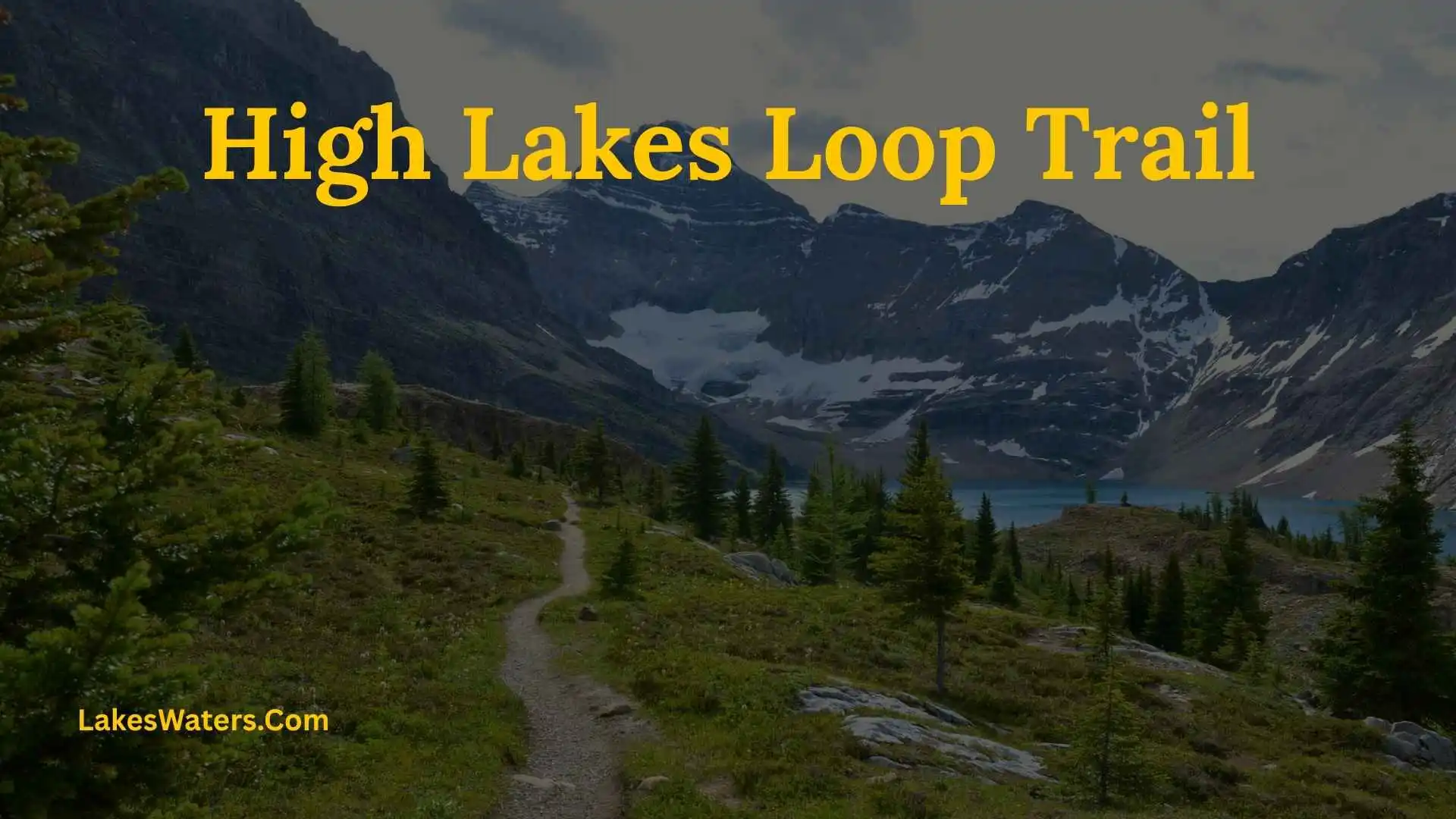
If you are searching for the High Lakes Loop Trail in Mount Rainier National Park, you are likely looking for a hike that combines subalpine lakes, wildflower meadows, forests, mountain views, and the scenery around Paradise and Reflection Lakes.
The name can be confusing because Mount Rainier has several connected trails in this area. The National Park Service describes a Lakes Loop between Paradise and Reflection Lakes as about 5 miles round trip with 1,300 feet of elevation gain, while the shorter Lakes Trail at Reflection Lakes is an approximately 3-mile loop. These routes connect with the High Lakes and Mazama Ridge trail network.
This guide explains what to expect, where the trail is located, how the routes connect, difficulty, distance, elevation gain, scenery, seasonal conditions, parking, safety, and nearby alternatives. It also explains which route to choose if you want a shorter lake hike or a longer outing from Paradise.
High Lakes Loop Trail Quick Answer
The High Lakes trail network is located in the Paradise area of Mount Rainier National Park in Washington and connects with trails around Mazama Ridge and Reflection Lakes. The longer Lakes Loop route between Paradise and Reflection Lakes is approximately 5 miles round trip with 1,300 feet of elevation gain according to National Park Service information. It passes through subalpine lakes, meadows, and forests.
For visitors starting at Reflection Lakes, the NPS also describes a separate approximately 3-mile Lakes Trail loop that climbs to a ridge, reaches Faraway Rock, and returns to Reflection Lakes.
That distinction matters when planning your hike because the two routes have different distances and elevation profiles.
High Lakes Loop Trail at a Glance
| Feature | Details |
| Location | Mount Rainier National Park, Washington |
| Main area | Paradise, Mazama Ridge, and Reflection Lakes |
| Longer Lakes Loop | About 5 miles round trip |
| Elevation gain | About 1,300 feet for the Paradise–Reflection Lakes loop |
| Difficulty | Moderate |
| Main scenery | Subalpine lakes, meadows, forests, and mountain views |
| Nearby landmark | Reflection Lakes |
| Nearby viewpoint | Faraway Rock |
| Road access | Stevens Canyon Road for Reflection Lakes |
| Best hiking season | Generally summer into early fall, depending on conditions |
| Dogs | Not permitted on park trails |
| Shorter alternative | Approximately 3-mile Lakes Trail loop at Reflection Lakes |
The National Park Service lists the Lakes Loop as a moderate 5-mile route with 1,300 feet of elevation gain and describes it as passing through subalpine lakes, meadows, and forests.
Where Is the High Lakes Loop Trail?
The trail system is in the Paradise area of Mount Rainier National Park, on the south side of Mount Rainier.
The route connects the high-country trails around Paradise with the Reflection Lakes area through the Lakes Trail and Mazama Ridge. An NPS trail junction guide identifies the Mazama Ridge/Lakes Trail as the route connecting toward the High Lakes trail and Reflection Lakes.
Reflection Lakes is approximately 1.3 miles east of the Paradise Road junction along Stevens Canyon Road. The area is known for views of Mount Rainier reflected in the lakes when conditions are calm.
Why the Trail Name Can Be Confusing
This is one of the most important things to understand before planning your hike.
Mount Rainier’s Paradise trail system contains several connected routes, including:
- High Lakes Trail
- Lakes Trail
- Mazama Ridge Trail
- Skyline Trail
- Wonderland Trail
- Reflection Lakes trails
Because these trails connect, online maps and trail websites may describe slightly different versions of a “High Lakes Loop.”
The National Park Service itself lists a 5-mile Lakes Loop from Reflection Lakes through Paradise, while its Reflection Lakes page describes a separate approximately 3-mile Lakes Trail loop.
For accurate trip planning, use the current NPS trail map and conditions rather than relying only on a third-party trail name.
How Long Is the High Lakes Loop Trail?
If you mean the longer Lakes Loop between Paradise and Reflection Lakes, the National Park Service lists it at approximately 5 miles round trip with about 1,300 feet of elevation gain.
If you mean the shorter loop beginning around Reflection Lakes, the NPS describes the Lakes Trail as approximately 3 miles. That trail climbs from the lake to a ridge, continues to Faraway Rock, and descends back toward Reflection Lakes.
This difference is important because a hiker expecting a short three-mile walk could accidentally plan for a substantially longer outing if they follow the connected route toward Paradise.
How Difficult Is the High Lakes Loop?
The longer Lakes Loop is classified as moderate by the National Park Service. Its approximately 1,300 feet of elevation gain means the hike is more demanding than a flat lake walk.
The difficulty also changes with weather and trail conditions.
Snow, mud, wet rocks, and slippery sections can make a moderate summer trail more challenging during spring or fall.
Is It Suitable for Beginners?
It can be suitable for beginners who are comfortable with several miles of hiking and sustained uphill sections.
A first-time mountain hiker should not judge the trail only by its mileage. The elevation gain and high-country conditions matter just as much.
If you are new to hiking, consider:
- Starting early
- Carrying enough water
- Allowing extra time
- Checking current trail conditions
- Using an official map
- Turning around if conditions become unsafe
The shorter Reflection Lakes loop may be a better introduction if you want a less demanding outing.
What Can You See Along the Trail?
One of the main strengths of this route is the variety of scenery packed into a relatively short distance.
Subalpine Lakes
The trail system passes through an area known for mountain lakes and wetland landscapes.
Reflection Lakes is the most famous nearby lake because Mount Rainier can appear in the water when the surface is calm. The NPS notes that the area is especially known for these reflections.
Wildflower Meadows
During the summer, the Paradise and Mazama Ridge area can contain colorful subalpine meadows.
The timing of blooms varies with snowmelt and weather, so a specific calendar date does not guarantee peak flowers.
Stay on designated trails. The park has worked to protect and restore damaged vegetation around Reflection Lakes, and visitors are asked not to shortcut trails or walk through sensitive meadow areas.
Mount Rainier Views
Mount Rainier is the defining mountain feature of the area.
Views change as the trail moves through forests, meadows, ridges, and lake areas. Clouds can also dramatically change the experience, so a partly cloudy day may still provide beautiful scenery.
Tatoosh Range
The Tatoosh Range is visible from several viewpoints around Reflection Lakes.
The shorter Lakes Trail also reaches Faraway Rock, which provides views toward the Tatoosh Range, Reflection Lakes, Louise Lake, and Stevens Canyon.
What Is the Route Like?
The exact experience depends on where you start.
Starting at Paradise
Starting near Paradise gives you access to the longer Lakes Loop route.
The route travels through the high-country landscape before continuing toward Reflection Lakes. Along the way, hikers encounter subalpine meadows, lakes, forests, and ridge terrain. The NPS lists the full Lakes Loop at about five miles with 1,300 feet of elevation gain.
This option makes sense if you want a fuller hike through the Paradise landscape rather than simply visiting Reflection Lakes.
Starting at Reflection Lakes
Reflection Lakes provides a convenient starting point for the shorter Lakes Trail.
The NPS describes this loop as approximately three miles. From the west side of the lake, the trail climbs toward the ridge, follows the ridge to Faraway Rock, and then descends toward Reflection Lakes.
This route gives you a good combination of lake scenery and higher viewpoints without committing to the full Paradise-to-Reflection Lakes loop.
What Is Special About Reflection Lakes?
Reflection Lakes is one of the best-known scenic areas in Mount Rainier National Park.
The lakes were named for their ability to reflect Mount Rainier. On calm mornings, the water can create a clear mirror-like image of the mountain.
The area also has an important conservation story.
Historically, recreational activities caused damage to the lakeshore and surrounding meadows. The park eventually ended fishing, boating, and swimming at the lakes and has worked to restore damaged areas.
That history explains why staying on designated trails is more than a simple park rule. It helps protect a fragile high-elevation landscape.
Best Time to Hike the High Lakes Loop
For most visitors planning a traditional hike, summer and early fall are the most practical seasons, subject to current road and trail conditions.
Summer Hiking
Summer provides the best chance of snow-free trails and accessible roads.
Wildflowers can also be a highlight during the summer season.
However, summer is a busy period at Mount Rainier. Parking can become limited, especially around popular trailheads and scenic stops. The NPS specifically warns visitors that parking along Stevens Canyon Road can be limited.
Early Fall
Early fall can bring cooler hiking temperatures and changing vegetation.
The exact conditions vary each year, so check the current NPS information before traveling.
Spring Conditions
Spring can be much more difficult than the calendar suggests.
Snow may remain on higher trails, and some sections may not resemble the dry summer trail shown in photographs.
The NPS notes that spring and fall can have snow patches covering portions of the Paradise trail system.
Winter Conditions
Winter changes the character of the area completely.
Reflection Lakes can still be reached by winter hikers and snowshoers, but vehicle access is seasonal. Stevens Canyon Road is generally open to vehicles during the summer season, typically from June through September.
Winter visitors need appropriate equipment, navigation skills, and experience with snow conditions.
How to Get to Reflection Lakes
Reflection Lakes is accessed from Stevens Canyon Road.
The NPS places Reflection Lakes approximately 1.3 miles east of the Paradise Road junction. The road is generally open to vehicles during the summer season, typically from late June through September, although exact opening and closing dates can vary.
Before driving, check the park’s current road status.
A route that is open in July may not be accessible by vehicle in another season.
Parking Tips for the Trail
Parking can be one of the biggest practical issues during busy summer days.
The National Park Service warns that parking along Stevens Canyon Road can be limited and recommends having an alternate plan.
How to Improve Your Chances of Finding Parking
Try these simple strategies:
- Arrive early during busy periods.
- Check road conditions before leaving.
- Follow all posted parking rules.
- Never block roads or emergency access.
- Have another nearby trail in mind.
- Avoid assuming that a full lot means roadside parking is permitted.
Planning the hike is only part of the trip. Planning where you can legally and safely park is just as important.
Are Dogs Allowed on the High Lakes Loop?
No. Pets are not allowed on Mount Rainier National Park trails.
This applies even when a trail appears short or easy.
The NPS Paradise trail information specifically states that pets are not allowed on trails.
Service animals are handled under applicable regulations.
What Should You Bring?
A day hike on this trail system does not require an expedition-style pack, but basic preparation is important.
Consider bringing:
- Water
- Food or snacks
- Hiking shoes with good traction
- Rain protection
- Warm layers
- Sun protection
- Navigation tools
- First-aid supplies
- Headlamp
- Emergency supplies
The National Park Service recommends carrying the Ten Essentials when hiking in Mount Rainier National Park.
Why Layers Matter
Mountain weather can differ from conditions at lower elevations.
A warm, sunny morning can become cool or wet later in the day. A light rain shell and extra layer take little space but can make the hike much more comfortable.
High Lakes Loop Safety Tips
Even a moderate day hike deserves careful preparation.
Check Conditions Before You Leave
Trail conditions can change because of snow, rain, storms, fallen trees, or other hazards.
The NPS recommends checking current trail conditions before hiking.
Stay on Designated Trails
This is especially important around the subalpine meadows.
Do not create shortcuts around muddy areas or leave the established route for photographs. The park has worked to restore damaged vegetation around Reflection Lakes.
Watch Your Footing
Rocky and uneven terrain can cause slips and ankle injuries.
Take your time on wet or unstable sections.
Do Not Approach Wildlife
Keep wildlife wild.
Never feed animals or approach them for photographs.
Carry Navigation
Several trails connect around Paradise, Mazama Ridge, and Reflection Lakes. A map helps you understand which route you are actually following.
High Lakes Loop vs. Reflection Lakes Lakes Trail
These routes are easy to confuse, so the difference is worth summarizing.
| Feature | Longer Lakes Loop | Reflection Lakes Lakes Trail |
| Approximate distance | 5 miles round trip | About 3 miles |
| Elevation gain | About 1,300 feet | Shorter loop; NPS does not give the same 1,300-foot figure for this route |
| Main area | Paradise to Reflection Lakes | Reflection Lakes and ridge |
| Difficulty | Moderate | Moderate |
| Main scenery | Lakes, meadows, forests, Paradise landscape | Reflection Lakes, Faraway Rock, Louise Lake, Stevens Canyon |
| Best for | A fuller half-day hike | A shorter scenic outing |
| Trail connections | High Lakes, Lakes, Mazama Ridge, Paradise trails | Connects with broader Paradise trail network |
The NPS specifically lists the longer Lakes Loop as 5 miles with 1,300 feet of elevation gain and the Reflection Lakes Lakes Trail as approximately 3 miles.
High Lakes Loop vs. Pinnacle Peak
Pinnacle Peak is another popular hike starting near Reflection Lakes.
The NPS describes Pinnacle Peak as a 2.5-mile round-trip trail climbing about 1,050 feet to a saddle in the Tatoosh Range. It is rocky and can retain snow into summer, with steep and exposed sections.
| Feature | High Lakes/Lakes Loop | Pinnacle Peak |
| Approximate distance | 5 miles for the longer loop | 2.5 miles round trip |
| Elevation gain | About 1,300 feet for the longer loop | About 1,050 feet |
| Terrain | Meadows, lakes, forests, ridges | Rocky and steeper |
| Main attraction | Lakes and broad scenery | Tatoosh Range viewpoint |
| Overall experience | Longer scenic hike | Shorter but steeper climb |
Choose based on the type of experience you want rather than distance alone.
High Lakes Loop vs. Bench and Snow Lakes
Bench and Snow Lakes are another nearby option along Stevens Canyon Road.
The NPS describes the Bench and Snow Lakes Trail as approximately 2.5 miles round trip, with gradual ups and downs through low ridges. Bench Lake is reached first, followed by Snow Lake.
This can be a good alternative when your main goal is visiting two mountain lakes rather than hiking the longer Paradise-to-Reflection Lakes route.
Is High Lakes Loop Good for Families?

The answer depends on the route and the hiking ability of your group.
The longer five-mile Lakes Loop includes significant elevation gain, so families should consider whether children are comfortable with several miles of uphill and downhill hiking.
The shorter Reflection Lakes Lakes Trail may be a better choice for families wanting a more compact outing, although it still includes uneven terrain and steeper sections.
For younger children, focus on the child’s actual hiking ability rather than a trail label such as “moderate.”
Is High Lakes Loop Good for Photography?
Yes. The trail system offers several different types of scenery.
Reflection Lakes Photography
Calm conditions can produce the famous Mount Rainier reflection.
The NPS notes that early morning is often particularly favorable when the air and water are still.
Faraway Rock
Faraway Rock provides elevated views toward Louise Lake and Stevens Canyon, as well as the Tatoosh Range and Reflection Lakes.
Wildflowers
Summer can bring colorful wildflowers to the subalpine meadows.
Photographers should stay on established trails instead of walking into flower patches.
Common Mistakes to Avoid
Mistake 1: Confusing the 3-Mile and 5-Mile Routes
This is the biggest planning mistake.
The Reflection Lakes Lakes Trail is approximately three miles, while the longer Lakes Loop between Paradise and Reflection Lakes is about five miles.
Always check the route on the official park map.
Mistake 2: Assuming All Routes Are Accessible Year-Round
Stevens Canyon Road is generally seasonal for vehicle access.
Check current road conditions before traveling.
Mistake 3: Walking Through Meadows
Leaving the trail for photographs or shortcuts can damage fragile vegetation.
Stay on designated paths.
Mistake 4: Ignoring Weather
Mountain weather can change quickly.
Carry layers and rain protection even when the forecast looks favorable.
Mistake 5: Arriving Without a Parking Plan
Popular areas can become crowded.
Have an alternate plan if the parking area is full.
Mistake 6: Bringing a Dog
Pets are not permitted on Mount Rainier’s hiking trails.
High Lakes Loop Decision Guide
Use this simple guide to choose the route that fits your plans:
Want a longer hike through Paradise and the Reflection Lakes area?
↓
Choose the approximately 5-mile Lakes Loop.
Want a shorter loop around Reflection Lakes with a ridge and Faraway Rock?
↓
Choose the approximately 3-mile Lakes Trail.
Want a steeper climb into the Tatoosh Range?
↓
Consider Pinnacle Peak.
Want to visit two nearby mountain lakes?
↓
Consider Bench and Snow Lakes.
Want to hike during winter?
↓
Check snow, road access, weather, and current NPS conditions before going.
High Lakes Loop Hiking Checklist
Before starting your hike, check each item:
- Confirm the exact route you plan to hike
- Check current Mount Rainier road conditions
- Check trail and snow conditions
- Check the weather forecast
- Plan for parking
- Carry enough water
- Bring food or snacks
- Wear suitable hiking footwear
- Carry rain and warm layers
- Carry navigation equipment
- Pack the Ten Essentials
- Stay on designated trails
- Do not feed or approach wildlife
- Leave pets at home
- Have an alternate plan if conditions change
Frequently Asked Questions About High Lakes Loop Trail
Where Does High Lakes Loop Trail Start?
The High Lakes/Lakes trail network can be accessed from the Paradise area and from Reflection Lakes, depending on the route you choose. The longer Lakes Loop connects Paradise with Reflection Lakes, while the shorter Lakes Trail begins around Reflection Lakes.
How Long Is High Lakes Loop Trail?
The longer Lakes Loop between Paradise and Reflection Lakes is approximately 5 miles round trip. The separate Lakes Trail loop at Reflection Lakes is approximately 3 miles.
How Much Elevation Gain Does the Lakes Loop Have?
The National Park Service lists approximately 1,300 feet of elevation gain for the 5-mile Lakes Loop.
Is High Lakes Loop Difficult?
The longer Lakes Loop is rated moderate. Its elevation gain and mountain terrain make it more demanding than a flat lake walk.
Can You See Mount Rainier From the Trail?
Yes. Mount Rainier is visible from parts of the Paradise and Reflection Lakes area, and Reflection Lakes is especially well known for its mountain reflections.
What Is Faraway Rock?
Faraway Rock is a viewpoint along the shorter Lakes Trail near Reflection Lakes. It overlooks Louise Lake and Stevens Canyon and provides views toward the Tatoosh Range and Reflection Lakes.
Are Dogs Allowed on High Lakes Loop?
No. Pets are not permitted on Mount Rainier National Park trails.
When Is the Best Time to Hike High Lakes Loop?
Summer and early fall are generally the most practical periods for a traditional hike, but conditions vary. Stevens Canyon Road is typically open to vehicles from late June through September. Always check current park information before visiting.
Can You Swim in Reflection Lakes?
No. Boating and fishing are not permitted at Reflection Lakes, and the park has restricted recreational activities there to protect the lake ecosystem.
Is Reflection Lakes the Same as High Lakes Loop?
No. Reflection Lakes is a scenic lake area and trailhead. The surrounding trail system connects several routes, including the Lakes Trail and High Lakes/Mazama Ridge routes. The longer Lakes Loop travels between Paradise and Reflection Lakes.
Is High Lakes Loop Open in Winter?
The area can be accessed by winter hikers and snowshoers, but normal vehicle access to Reflection Lakes is seasonal. Winter travel requires appropriate preparation and current information about snow and road conditions.
Conclusion
The High Lakes Loop Trail area offers one of the most varied hiking experiences around Mount Rainier’s Paradise and Reflection Lakes region. Instead of seeing only one landscape, hikers can move through subalpine meadows, forests, lakes, ridges, and viewpoints with Mount Rainier and the Tatoosh Range adding a dramatic mountain backdrop.
The most important planning detail is understanding the route names. The National Park Service describes the longer Lakes Loop between Paradise and Reflection Lakes as about 5 miles with 1,300 feet of elevation gain, while the separate Lakes Trail around Reflection Lakes is approximately 3 miles.
For the best experience, check current road and trail conditions, plan for changing mountain weather, arrive prepared for elevation gain, and stay on designated trails. If you want a longer mountain outing, choose the Paradise-to-Reflection Lakes loop. If you prefer a shorter scenic hike, the Reflection Lakes Lakes Trail offers a more compact alternative.
Most importantly, use the current National Park Service information when planning your visit because road access, snow, trail conditions, and park restrictions can change from season to season.

I am Daniel Brooks, an environmental enthusiast and writer focused on freshwater resources and the connection between humans and nature.
I enjoy researching lakes, wetlands, and water conservation practices to create informative content for readers. I believe that understanding our water systems is the first step toward protecting them.
Through my writing, I aim to inspire awareness and responsible actions for a better water future.
Books by Daniel Brooks:
- Freshwater Wonders: Stories From the World’s Lakes
- Protecting Our Blue Planet: Water Conservation Guide